Even though Earth looks calm and unchanging from space, it’s alive and breathing to the rhythm of its own processes. Wind, water, ice, and tectonic forces are constantly changing the landscape. Sometimes it happens slowly, over millions of years, and sometimes it’s sudden and dramatic, happening in just a few minutes. The polar regions of the Arctic and Antarctic are a unique showcase for these changes, where the interaction between the elements and geology is clearly visible.
Artist Who Changes Landscapes
Erosion is the process by which rocks and soil are gradually broken down and transported from one place to another. It differs from weathering, which only breaks down material but does not move it. Erosion is caused by three main agents: wind, water, and ice, each of which leaves its own distinctive “signature” on the planet’s surface.
Main causes and effects of erosion:
- the transport of soil and sand by water or wind;
- the erosion of riverbanks and valleys;
- the thinning of the fertile soil layer;
- the silting up of rivers and lakes;
- the destruction of ecosystems and habitats.
Although erosion is a natural process, human activity often accelerates it. Deforestation, construction, and agriculture often expose the soil, making it vulnerable. Measures such as planting trees and creating terraces on slopes help to reduce the rate of destruction.
Majestic Sculptors of the Arctic
In high latitudes, glaciers play a major role in changing the landscape. These gigantic ice masses move slowly, tearing away and grinding down the rock. Scientists identify two main mechanisms of glacial erosion: plucking and abrasion.
- Plucking occurs when ice melts at the base and meltwater seeps into cracks in the rock. As it freezes, it “pushes out” pieces of rock, which are then carried away with the glacier.
- Abrasion is the grinding of rock by ice mixed with stones, resulting in a fine mineral powder that colors meltwater gray.
In recent decades, coastal erosion caused by climate warming and the melting of permafrost has become increasingly noticeable in the Arctic, making the coast vulnerable to waves and storms.
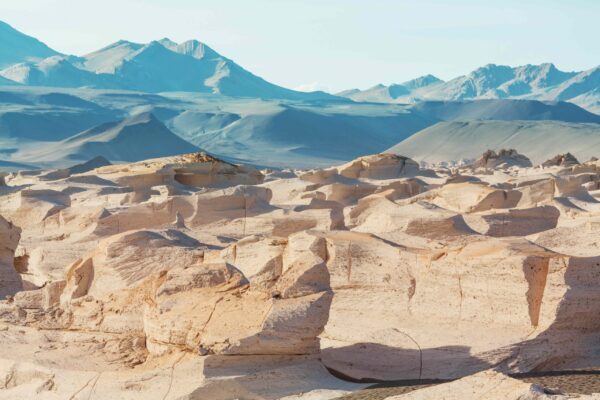
Invisible Carver of Antarctica
In Antarctica, winds play as important a role in shaping the landscape as glaciers. The influence of katabatic winds, streams of cold, dense air flowing from the ice sheets to the coast, is particularly noticeable. This process seems slow, but over thousands of years it can radically transform the appearance of rocks, giving them shapes that sometimes resemble works of modern art.
Planetary Architecture
The Earth’s lithosphere consists of tectonic plates that move at a speed of only a few centimeters per year, but it is these movements that have changed the map of the world over millions of years. Geological data from Antarctica confirm that it was once part of the supercontinents Rodinia and Pangea and had a much warmer climate.
Impact of plate movement:
- changes the configuration of continents and oceans;
- causes earthquakes and volcanic activity;
- forms mountain ranges;
- creates new areas of the ocean floor;
- opens up access to mineral resources.
Plate tectonics is a fundamental force that determines not only the relief, but also the climate and the evolution of living organisms.
Destructive Force
Volcanoes have been known since ancient times for their destructive power. They are places where magma rises from the mantle to the surface, turning into lava. Most volcanoes are located at the boundaries of tectonic plates, but some, such as those in Hawaii, form above “hot spots.” The type of eruption depends on the silica and gas content: viscous lava with a high silica content often leads to powerful explosions, while liquid lava leads to calm lava flows.
Mount Erebus in Antarctica deserves special attention. It is one of the few volcanoes on Earth with a permanent lava lake. Studying it helps scientists understand the internal dynamics of volcanoes. Expeditions to Erebus continue unabated, despite the extremely harsh conditions.
Impulses from the Depths
Earthquakes most often occur at plate boundaries when their uneven edges get stuck and then suddenly slip. Seismic activity is not as high in polar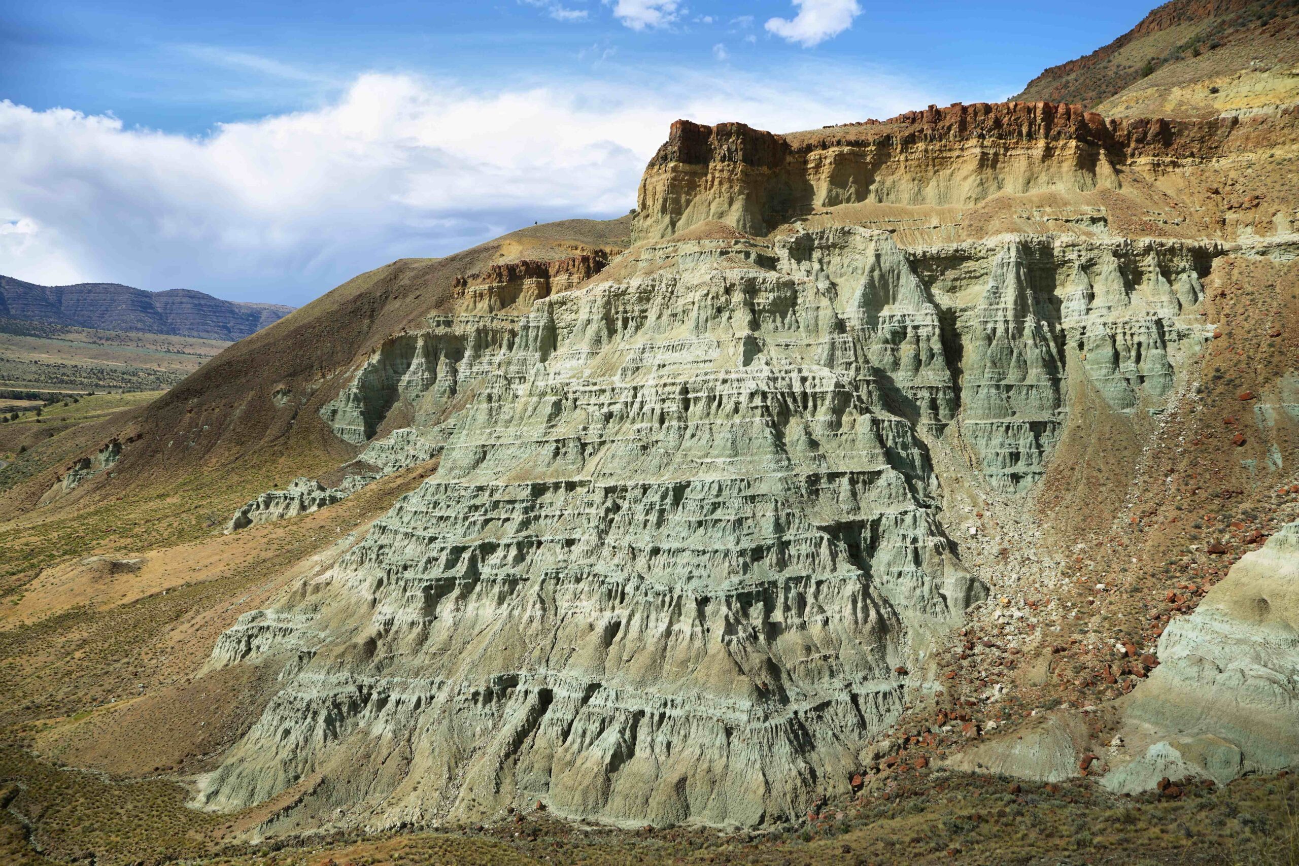 regions, but it does occur, especially in areas associated with volcanism, such as the Gakkel Ridge in the Arctic Ocean. Small earthquakes usually accompany underwater volcanic eruptions.
Earthquakes in the Antarctic region are mainly associated with the activity of Mount Erebus and local tectonic processes. Studying them helps predict volcanic behavior and better understand the Earth’s internal structure.
Key to Understanding Earth
Scientists have been studying the Arctic and Antarctic for decades to learn about Earth’s past and predict the future of our planet.
Polar research is important for:
- understanding the global climate;
- predicting sea levels;
- studying geological processes in extreme conditions;
- developing methods to protect coastlines from erosion;
- assessing the impact of climate change on ecosystems.
Such regions serve as natural laboratories where you can see how the forces that shape the Earth interact.
Listen to the Voice of the Planet
The Earth is constantly changing under the influence of forces that we sometimes cannot even see. Wind, ice, volcanoes, and tectonic forces interact in the most unpredictable ways, creating amazing combinations of landscapes and natural areas. It is within our power to analyze these processes and draw important conclusions that will help us better understand the world we live in.
We encourage you to follow scientific research, support nature conservation projects, and share your knowledge with others. By understanding how the Earth works, we can better understand how to preserve it for future generations.